Toponym
Situated in the very southwest of Cilicia, the sancak of İçil / İçel roughly corresponded to Cilicia Trachaea of the antiquity. İçil literally means ‘inner territory’. Bordering the Mediterranean Sea and the Tauros (Trk.: Toros) Mountains, which are mostly impassable (except for the Sertavul Pass), this isolation may be the reason why the name was first documented in the 12th century by Seljukid Turks. They used the name only for the Göksu River (Gr.: Kalykadnos) valley. But soon it became the name of a wider territory.
Administration
The region called İçel or İçil by the Karamanid Principality and called the İçel Sancak by the Ottomans, comprised in its narrowest form, today’s Selinti (Gazipaşa), Anamur, Bozyazı, Gilindire (Aydıncık), Gülnar, Ermenek, Başyayla, Sarıveliler. It covered the districts (kazas) of Mut, and Silifke in its widest form. The administrative seat of the sancak was the town of Silifke (also Selefke; ancient Seleucia). Although the eastern borders of the Silifke district were not known exactly at that time, it is understood from the maps of the period that it was up to the border of the Tarsus district. The sancak of Içil was affiliated to the Eyalet of Cyprus from 1571 to 1868 (except for a short period when Ermenek was the center of the sancak). With the arrangement made in 1868, the İçil sancak was joined with the Adana Eyalet. In 2002, the eight-century old name İçel was abandoned and the administrative unit was named “Mersin Province”.
According to the official map drawn by Vital Cuinet in the early 1890s, the east border of İçil was the Alata River and the west border was an unidentified river just to the east of Alanya (may be Dim River). The northern border followed the summit line of the mountains.
According to salname (annual) of Adana Vilayet, there were six kazas (cantons) in this Ottoman sancak: Anamur, Ermenek, Gülnar, Karataş, Mut, and Silifke.
Armenian Population
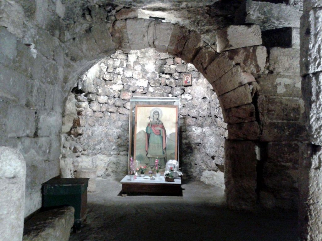
According to the census of the Armenian Apostolic Patriarchate in Constantinople, before the First World War, 466 Armenians lived in the sancak of Içil, namely in its center Silifke and in Mala (pop. 95). There was one Armenian church in each of the two localities.[1]
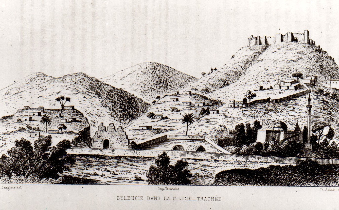
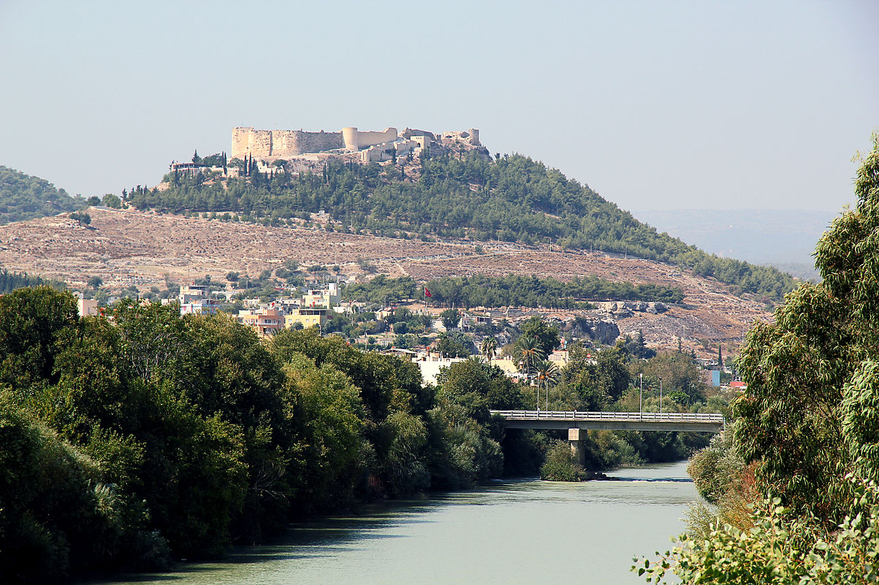
Town of Silifke / Σελεύκεια – Seleukeia
Silifke is near the Mediterranean coast, on the banks of the Göksu River, the Calycadnus (Grk.: Kalykadnos) of antiquity, which flows from the nearby Taurus Mountains, surrounded by attractive countryside along its river banks. Silifke’s strategic significance is known since late antiquity. In the Middle Ages, it played an important role in the Armenian Crusader history.
Toponym
Silifke was formerly called Seleucia on the Calycadnus — variously cited over the centuries as Seleucia [in] Cilicia, Seleucia [in, of] Isauria, Seleucia Trachea, and Seleucia Tracheotis. The city took its name from its founder, King Seleucus I Nicator. The modern Turkish name derives from the Latin Seleucia which comes from the Greek Σελεύκεια (Seleuceia).
History
Located a few miles from the mouth of the Göksu River, Seleucia was founded by Seleucus I Nicator in the early 3rd century B.C., one of several cities he named after himself. It is probable that there were more ancient towns, called Olbia (or Olba) and Hyria and that Seleucus I merely united them giving them his name. The city grew to include the nearby settlement of Holmi (Grk.: Ὅλμοι, Holmoi; modern-day Taşucu) which had been established earlier as an Ionian colony but situated on the coast Holmi was vulnerable to raiders and pirates. The new city up river was doubtless seen as safer against attacks from the sea so Seleucia achieved considerable commercial prosperity as a port for this corner of Cilicia (later named Isauria), and was even a rival of Tarsus.
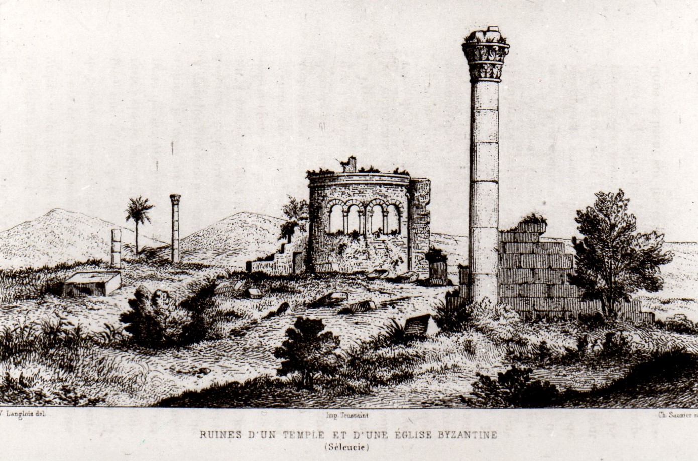
Cilicia thrived as a province of the Romans, and Seleucia became a religious center with a renowned 2nd century Temple of Jupiter. It was also the site of a noted school of philosophy and literature, the birthplace of peripatetics Athenaeus and Xenarchus. The stone bridge was built by the governor L. Octavius Memor in 77 A.D. Around 300 A.D. Isauria was established as an independent state with Seleucia as its capital.
Christianity
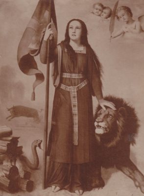
Early Christian bishops held a Council of Seleucia in 325, 359, and 410. Seleucia was famous for the tomb of the virgin Saint Thecla of Iconium, converted by the apostle Saint Paul, who died at Seleucia. Her tomb was one of the most celebrated in the Christian world and was restored several times, among others by the Emperor Zeno in the 5th century. Today the ruins of the tomb and sanctuary are called Meriamlik.
In the 5th century the imperial governor (comes Isauriae) in residence at Seleucia had two legions at his disposal, the Legio II Isaura and the Legio III Isaura. From this period, and perhaps later, dates the Christian necropolis, west of the town, which contains many tombs of Christian soldiers. According to the Notitia Episcopatuum of the Patriarchate of Antioch, in the 6th century, the Metropolitan of Seleucia had twenty-four suffragan sees.
In 705 Seleucia was captured by the Arab armies of Islam and was recovered by the Byzantines. Thus by 732 nearly the entire ecclesiastical province of Isauria was incorporated into the Patriarchate of Constantinople; henceforth the province figures in the Notitiae of the Patriarchate of Constantinople, but under the name of Pamphylia.
In 968 Antioch again fell into the power of the Byzantines, and with the Province of Isauria, Seleucia was allocated to the Patriarchate of Antioch.
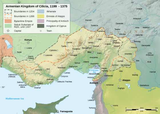
In the 11th century, the city was captured by the Seljuk Turks; they met with resistance, and in 1137 Seleucia was besieged by the Rubenid Prince Levon I of Cilician Armenia. During this period of struggle between Armenians, Byzantines, Crusaders, and Turks, a stronghold was built on the heights overlooking the city.
The Byzantines expanded the fortress to protect themselves from the Muslims.
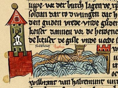
On 10 June 1190, the Emperor Frederick Barbarossa drowned trying to cross the Calycadnus, near Seleucia during the Third Crusade.
In the 13th century Seleucia was in the possession of the Hospitallers, who lost it to the Karamanid Principality in the second half of the 13th century, and then it ended up in the hands of the Ottomans under general Gedik Ahmet Pasha in 1471.
Destruction
The Armenians of the sancak of Içel were expelled in September 1915 under the supervision of Ata Bey.[2]